
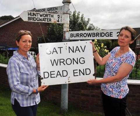
FRUSTRATED villagers are warning motorists not to rely too much on their Sat Navs after confused summer drivers were finding themselves stuck on a river bank.
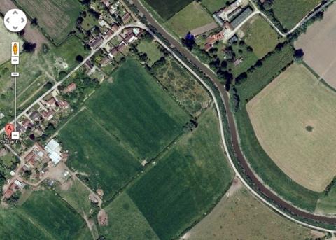
Signs have been put up throughout Northmoor Green warning people not to follow their navigation devices, which try to guide drivers down a narrow road next to the River Parrett, toward a dead end.
Kate Symonds, from Northmoor Green, said: “Every now and then we get large vehicles, including cars and lorries, stuck on the river bank.
“They’ve followed their sat navs thinking it’s a proper road along the river, when it’s actually very narrow and leads to a dead end. We’ve even had a gas tanker stuck there in the past.
“There are about three official signs in place to warn people, but they still get stuck down there.
“It’s caused quite a bit of chaos for residents, especially if the motorway is blocked and people are trying to find alternate routes. It’s usually more of a problem in the summer, with tourists, as the motorway gets blocked more then.”
Maria Maye, from Fordgate, has also noticed the problem. She told the Mercury: “It starts just opposite the church as if you’re going from Huntworth to Burrowbridge.
“There’s a signpost which point different directions, with one branch which says Northmoor Green. Only if you follow it, it just leads to a dead end.
“People keep follow their sat navs down there so some of the villagers put up a sign to warn people.”
Wayward sat navs are not a new problem for Sedgemoor, as the Mercury reported here when a lorry got wedged in a narrow lane in Combwich after the driver followed his sat nav.


Comments: Our rules
We want our comments to be a lively and valuable part of our community - a place where readers can debate and engage with the most important local issues. The ability to comment on our stories is a privilege, not a right, however, and that privilege may be withdrawn if it is abused or misused.
Please report any comments that break our rules.
Read the rules hereLast Updated:
Report this comment Cancel